Map Showing the Centers Of Population, 1790-1920
These two maps from the 1925 Statistical Atlas of the United States offer regional and national geographical representations of the changing centers of population in the United States from 1790 to 1920.
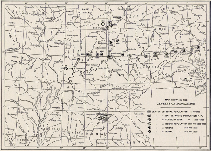
CENTERS OF POPULATION
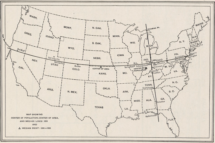
CENTER OF POPULATION, CENTER OF AREA, AND MEDIAN LINES: 1920