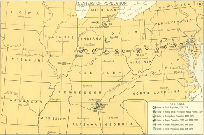
Centers of Population
This map from the 1932 Atlas of the Historical Geography of the United States offers a geographic rendering of the United States' center of population from 1790 to 1930. It references six organizational categories, including total population, urban population, rural population, foreign-born population, and Negro population.
CENTERS OF POPULATION