Centers of Population
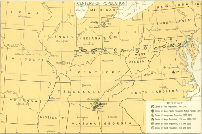
This map from the 1932 Atlas of the Historical Geography of the United States offers a geographic rendering of the United States' center of population from 1790 to 1930. It references six organizational categories, including total population, urban population, rural population, foreign-born population, and Negro population.

CENTERS OF POPULATION
About this Document
- Source: Atlas of the Historical Geography of the United States
- Author: Charles O. Paullin and John K. Wright
- Publisher: Carnegie Institute of Washington and the American Geographical Society of New York
- Published: Washington, D.C.
- Citation: page 80
- Date: 1932
- Topics: Migration/Transportation
- Further Information: About the Encoding