Railroads 1850 and 1860; Overland Mail, 1850-1869
These two maps from the 1932 Atlas of the Historical Geography of the United States display overland mail routes and railroad lines in the United States during the mid-nineteenth century. The maps show the extent of railroads in 1850 and 1860 and overland mail from 1850 to 1869.
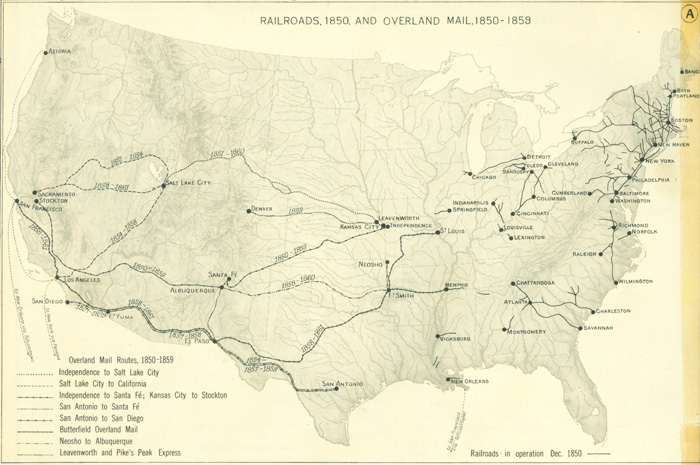
RAILROADS, 1850, AND OVERLAND MAIL, 1850-1859
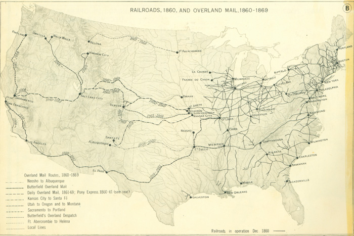
RAILROADS, 1860, AND OVERLAND MAIL, 1860-1869