Western Railroad Lines, 1880 and 1930
These two maps from the 1932 Atlas of the Historical Geography of the United States depict the extent of western railroads in 1880 and 1930. They illustrate the tremendous growth of the railroad in the western United States during this fifty-year period.
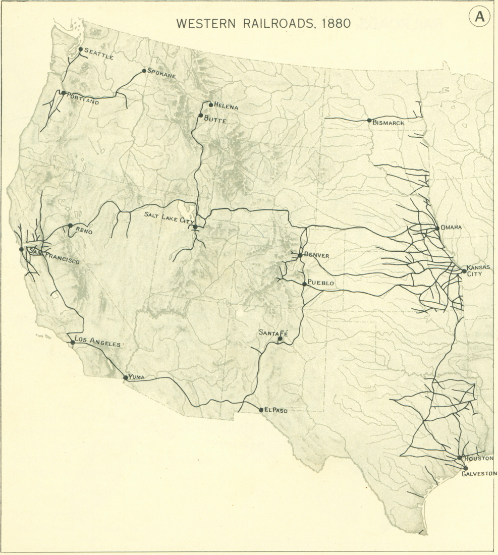
WESTERN RAILROADS, 1880
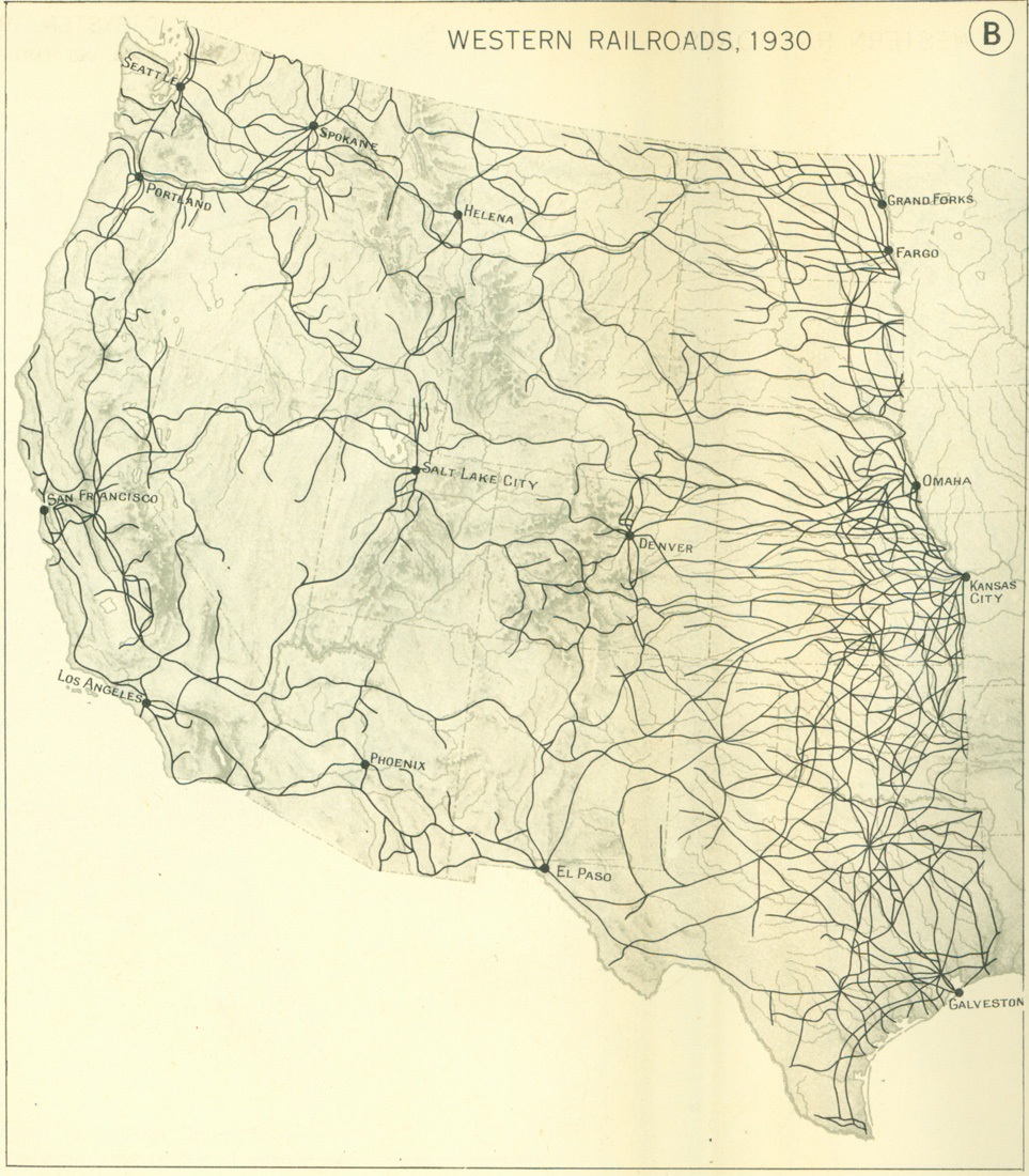
WESTERN RAILROADS, 1930