Railroad Travel Rates, 1800-1930
This series of maps from the 1932 Atlas of the Historical Geography of the United States shows the progressive decrease in travel time by depicting the time required to travel from New York to various western locations in 1800, 1830, 1857, AND 1930.
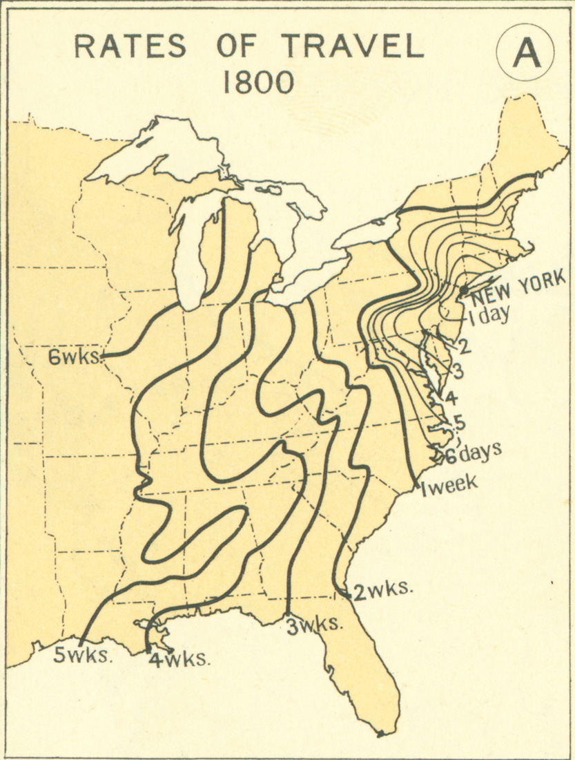
RATES OF TRAVEL 1800
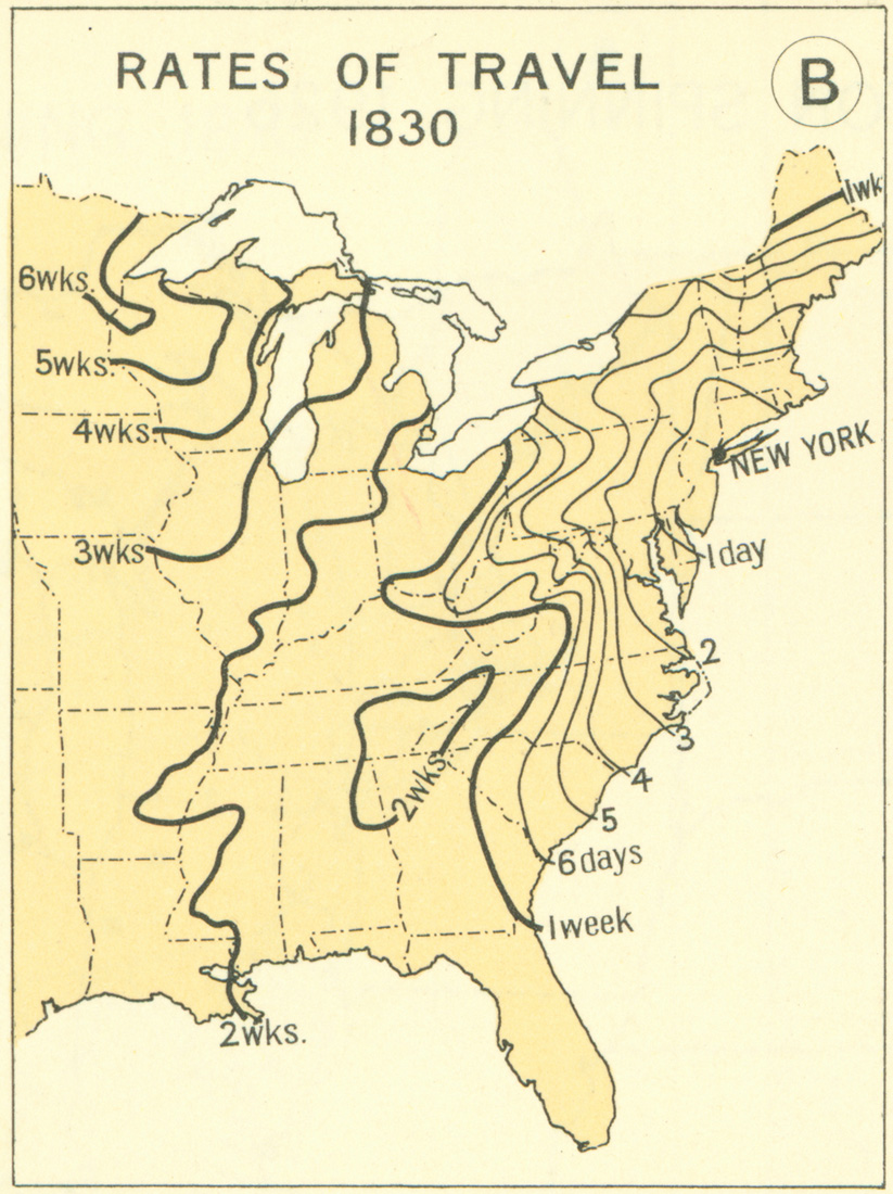
RATES OF TRAVEL 1830
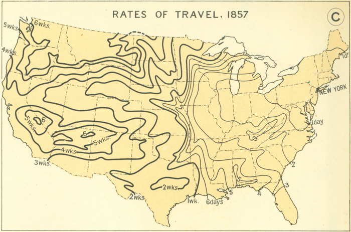
RATES OF TRAVEL 1857
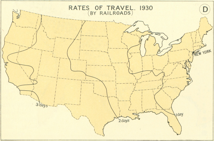
RATES OF TRAVEL 1930 (BY RAILROADS)