Views
Views are short interpretive historical presentations from materials in the Railroads collection. Each View is aimed a research question or problem and assembles information from multiple sources: documents, lists, records, orginal maps, and other historical sources. Rather than using traditional footnotes or citations, these Views contain direct links and references to relevant sources used in their assembly. Views are "assemblages" of data and interpretation and should be considered multimedia experiments in the presentation of digital history.
The Growth of Slavery and Southern Railroad Development
Southern railroads extended in the 1850s to places where slavery was not yet firmly established by white planters. The upcountry South, the Appalachian mountains, and the western borders of the South were all areas of significant railroad development. Wherever railroads went, slavery and some form of plantation agriculture followed. White southerners saw little inconsistency between slavery and industrial development, especially railroads.
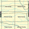
Land Sales in Nebraska: Comparing Two Nebraska Counties on the Burlington Railroad
When construction of its main trunk began in 1869, The Burlington & Missouri River Railroad in Nebraska received a significant land grant from the federal government. The railroad joined the federal government, local governments at all levels, boosters, and other corporations in efforts to “colonize” the region. The railroad not only shaped the western landscape by privileging access to its network, junctions, and depots, but also shaped the western experience by enabling widespread mobility, immigration, and ethnic diversity. The railroad's modernizing influence took many forms but the marketing, selling, and opening of its lands had especially significant long-term effects on the Great Plains. By Kurt Kinbacher, William G. Thomas, Dan Becker, and Zach Bajabar.
Northern Expansion in the 1850s
The Illinois Central Railroad received the first federal land grant in September 1850. The area comprised some 2,595,000 acres in Illinois. The railroad opened the lands for sale in 1852 and began a sophisticated land marketing and promotion operation to attract settlers onto the prairies. The Land Department advertised in Europe, printed detailed brochures explaining how lands could be bought with ten-year mortgages, and provided excursion rates for land settlers to travel west and see the lands for themselves. The rapidity of the sales fueled extraordinary growth of towns along the line. Northern railroad expansion in the Midwest matched Southern railroad growth in the 1850s. Both sections understood their development in sectionalized terms.
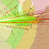
Travel Time--How Railroads Shaped Time and Space
Henry Adams, in The Education of Henry Adams, remarked, "The generation between 1865 and 1895 was already mortgaged to the railways, and no one knew it better than the generation itself." The railroads were a centripetal and centrifugal force, a kind of powerful vortex, in American society. Their reach into the lives of everyday Americans, was Henry Adams' chief concern. He could see that railroads were "but one active interest, to which all others were subservient, and which absorbed the energies of some sixty million people to the exclusion of every other force, real or imaginary." Railroad corporations employed thousands and their services spanned the continent, reshaping the economies and social relations in whole regions. For everyday Americans the railroad cut travel time and changed the spatial relationships in their lives.
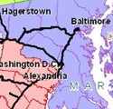
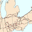
Network Connectivity--A Close Analysis of the Baltimore and Ohio Railroad's Expansion
The Baltimore and Ohio Railroad was the first railroad to break through the Allegheny Mountains and reach the Ohio River. The route to the Ohio was completed in1857, but throughout the nineteenth century the company acquired other railroads, expanded its operations, and reconstituted its system. This view explores the dynamic expansion and contraction inherent in these systems. Rather than a uniform process of growth, railroads underwent spatially uneven and disjointed development over long periods of time. By Richard G. Healey and William G. Thomas.

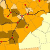
Map Inaccuracies in Railroad Sources
Developing a Historical Geographic Information System (H-GIS) for railroads in the United States reveals numerous inaccuracies in historical railroad atlases and maps. In this case study we examine some of the problems we faced in developing and integrating rail GIS from the University of Nebraska and the University of Portsmouth.