Maps and Additional Map Images
All maps produced for The Iron Way are copyrighted and may not be reproduced for sale or redistribution without permission of Yale University Press and the author.
*additional images not in original text
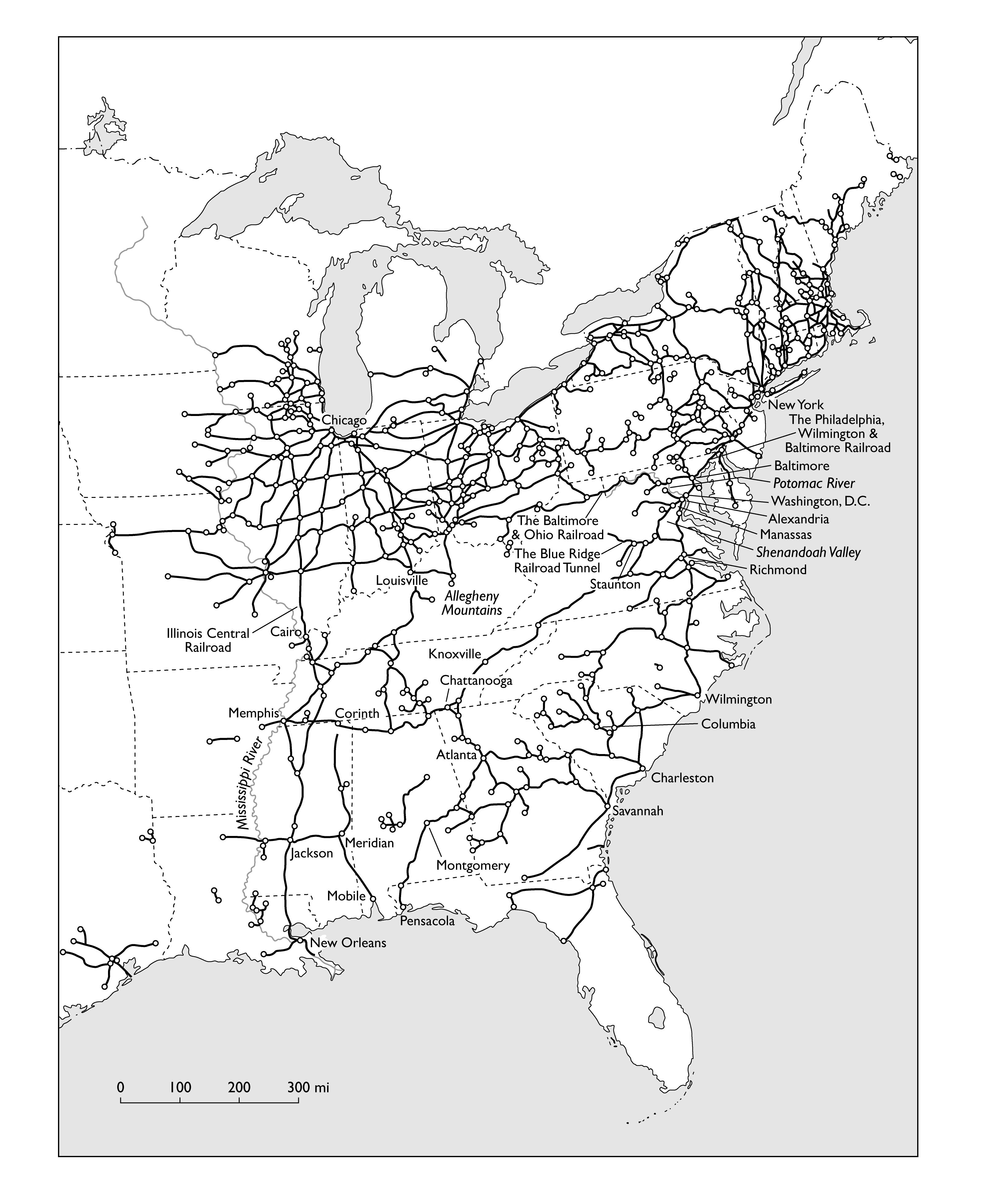
Map 1: The United States in 1861, showing principal railroads and junctions.
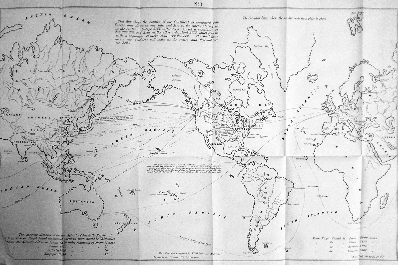
*Asa Whitney, Map No. 1 from "A Project for a Railroad to the Pacific," 1849.
(Courtesy Creighton University Library)
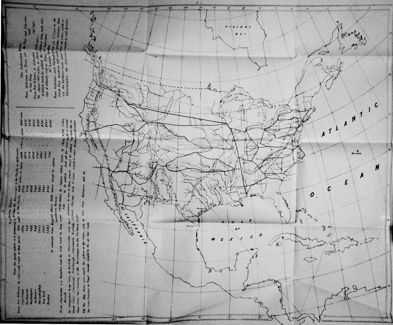
*Asa Whitney, Map No. 2 from "A Project for a Railroad to the Pacific," 1849.
(Courtesy Creighton University Library)
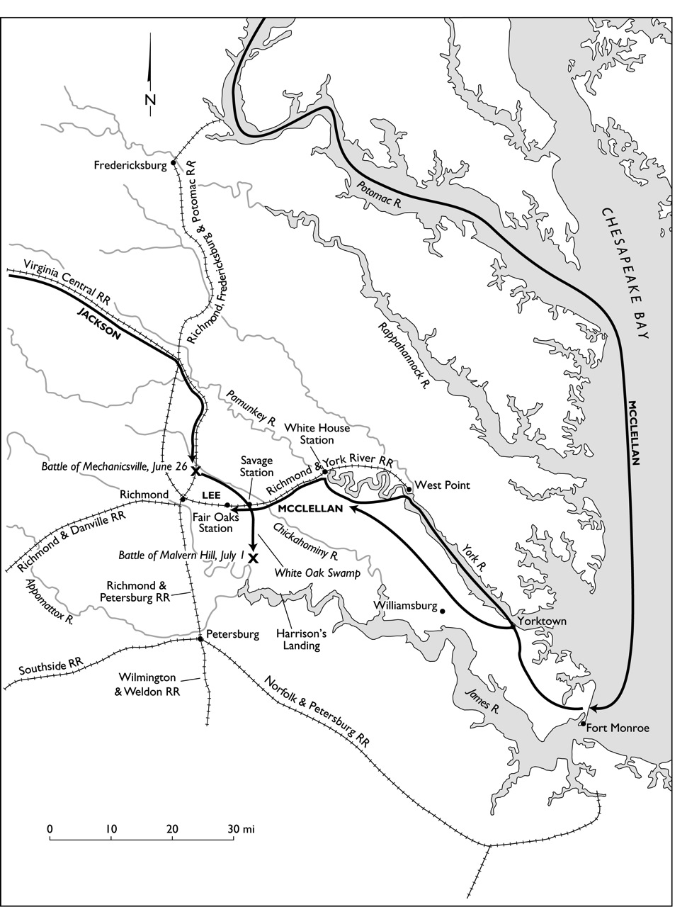
Map 2: The Peninsular Campaign, March to July 1862.
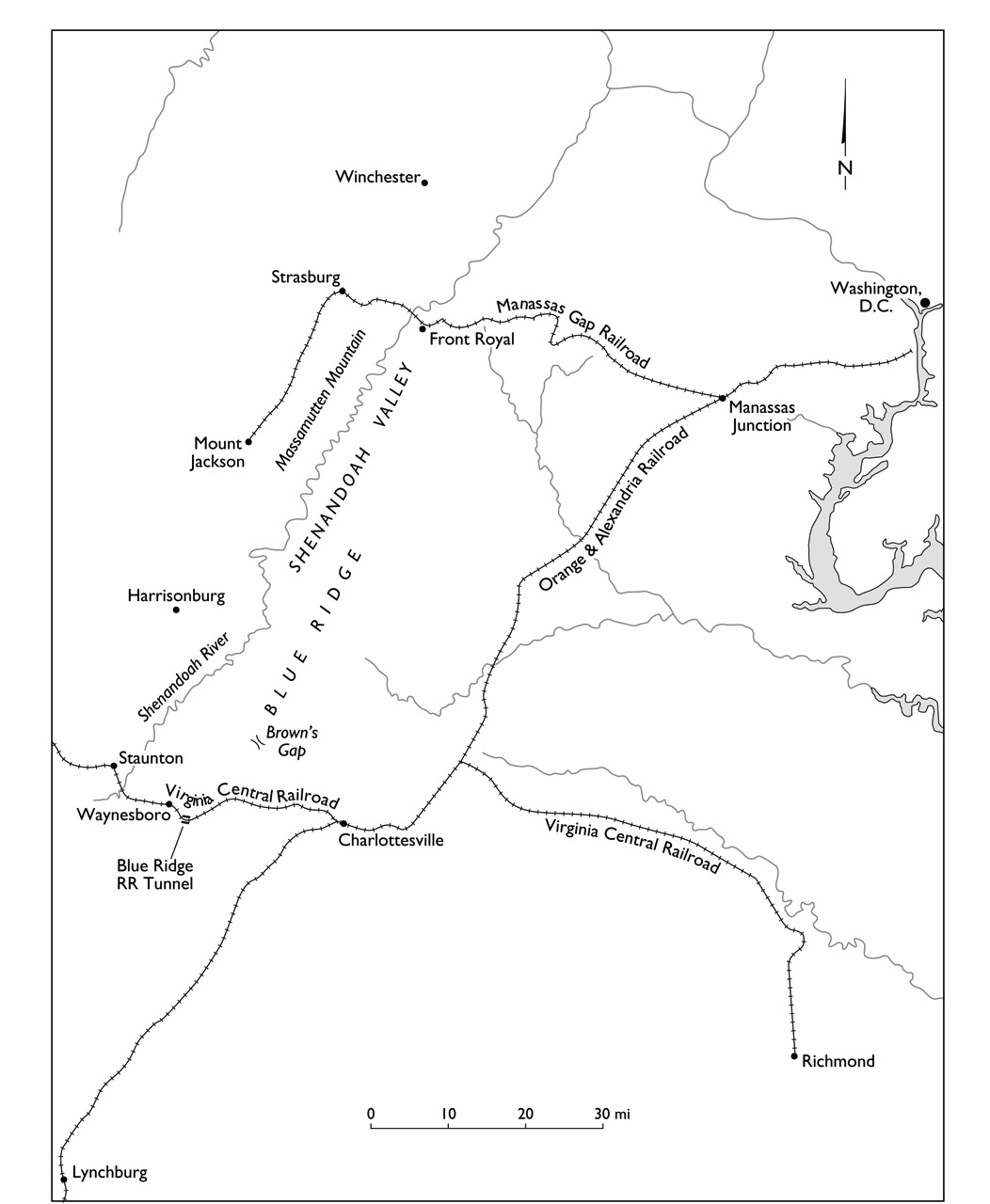
Map 3: The Shenandoah Valley, Virginia.
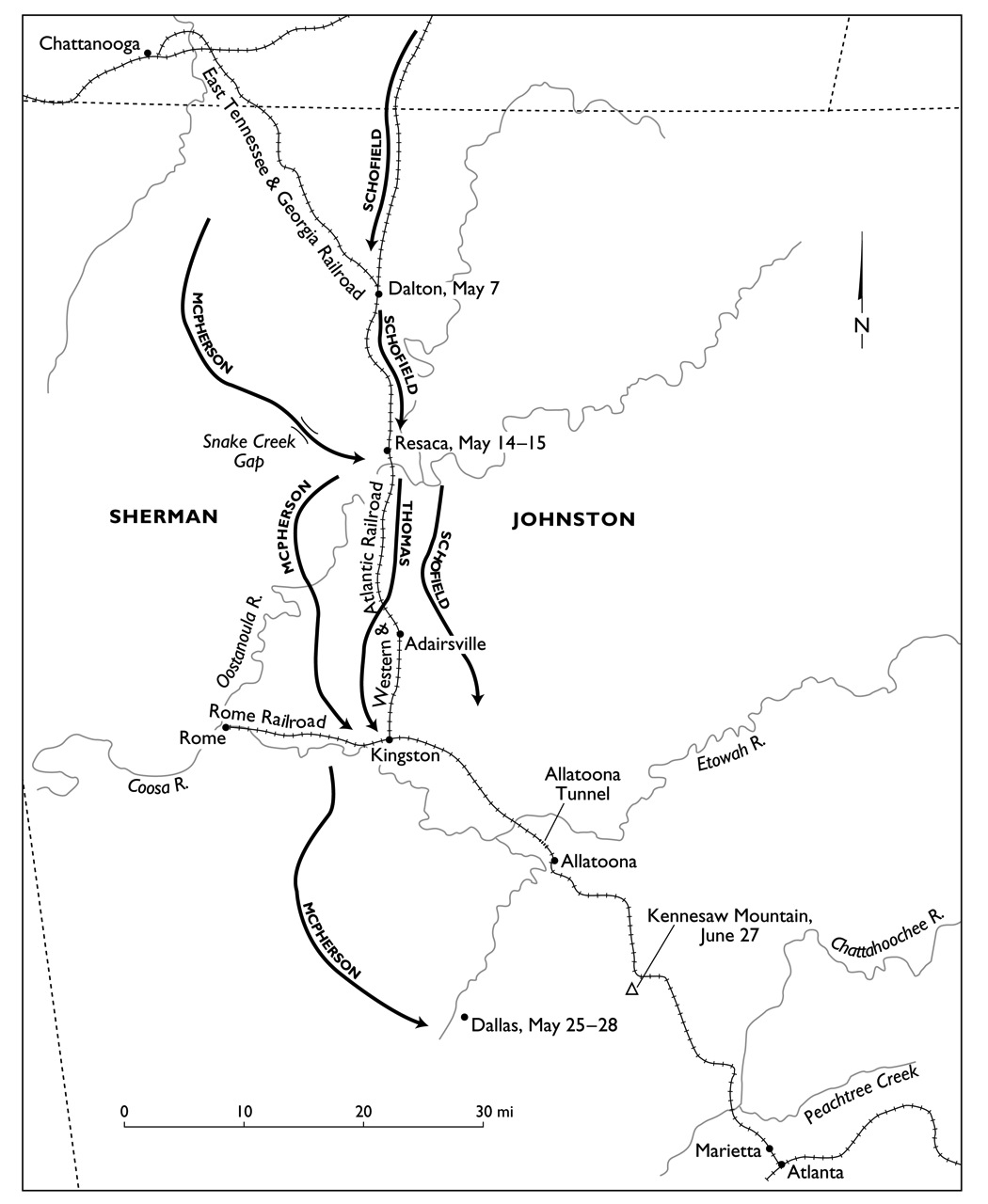
Map 4: The Atlanta Campaign, May to July 1864.
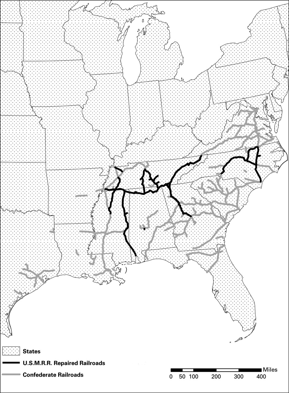
Map 5: Railroads across the South repaired by U.S. Military Railroads in 1865.
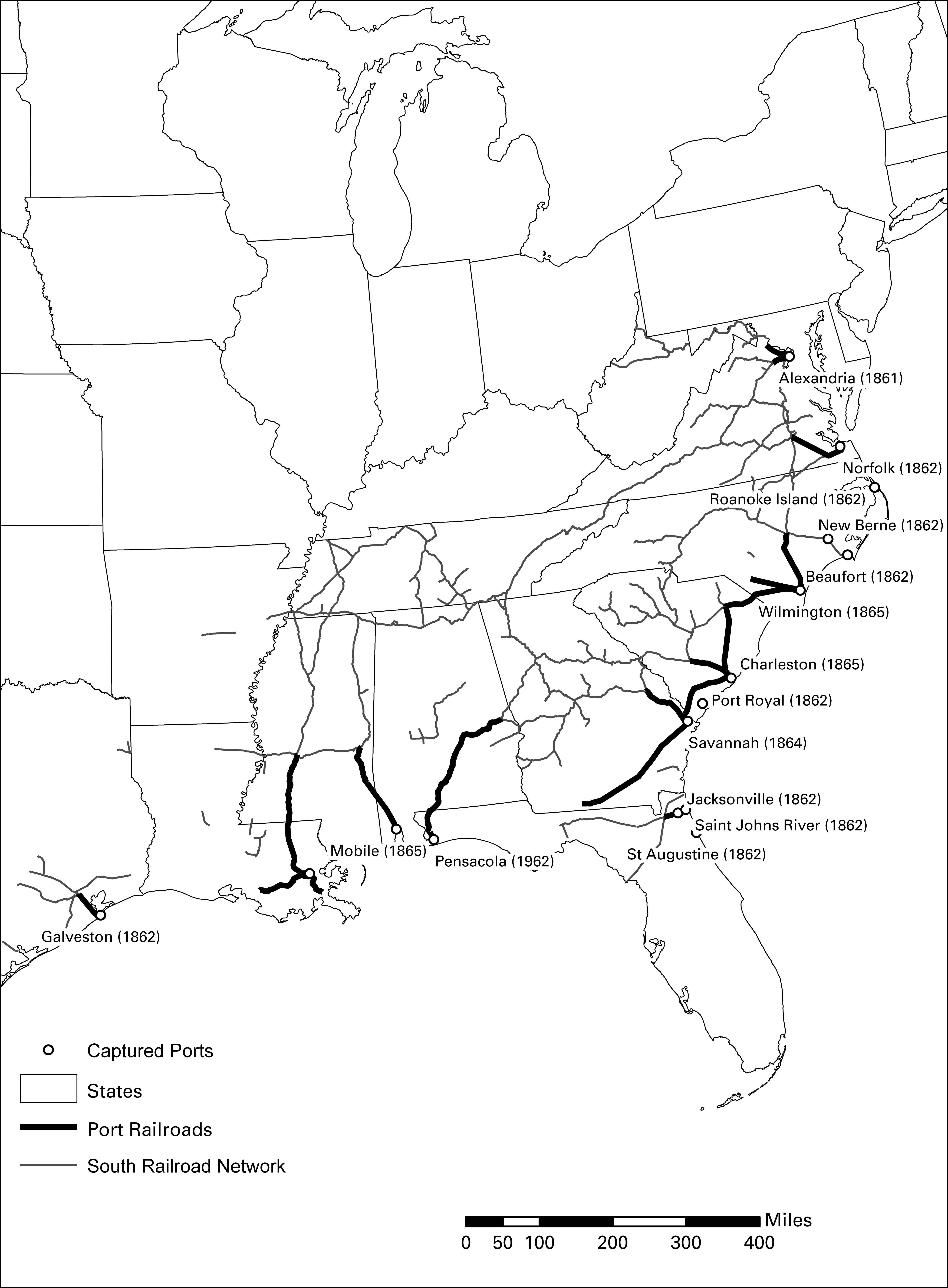
*Map 6: Captured Ports in the Confederate States, with principle railroad networks (unpublished draft)